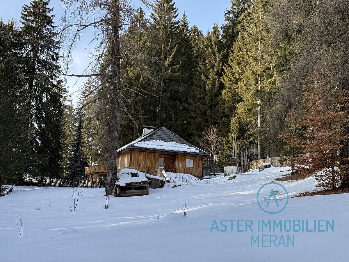
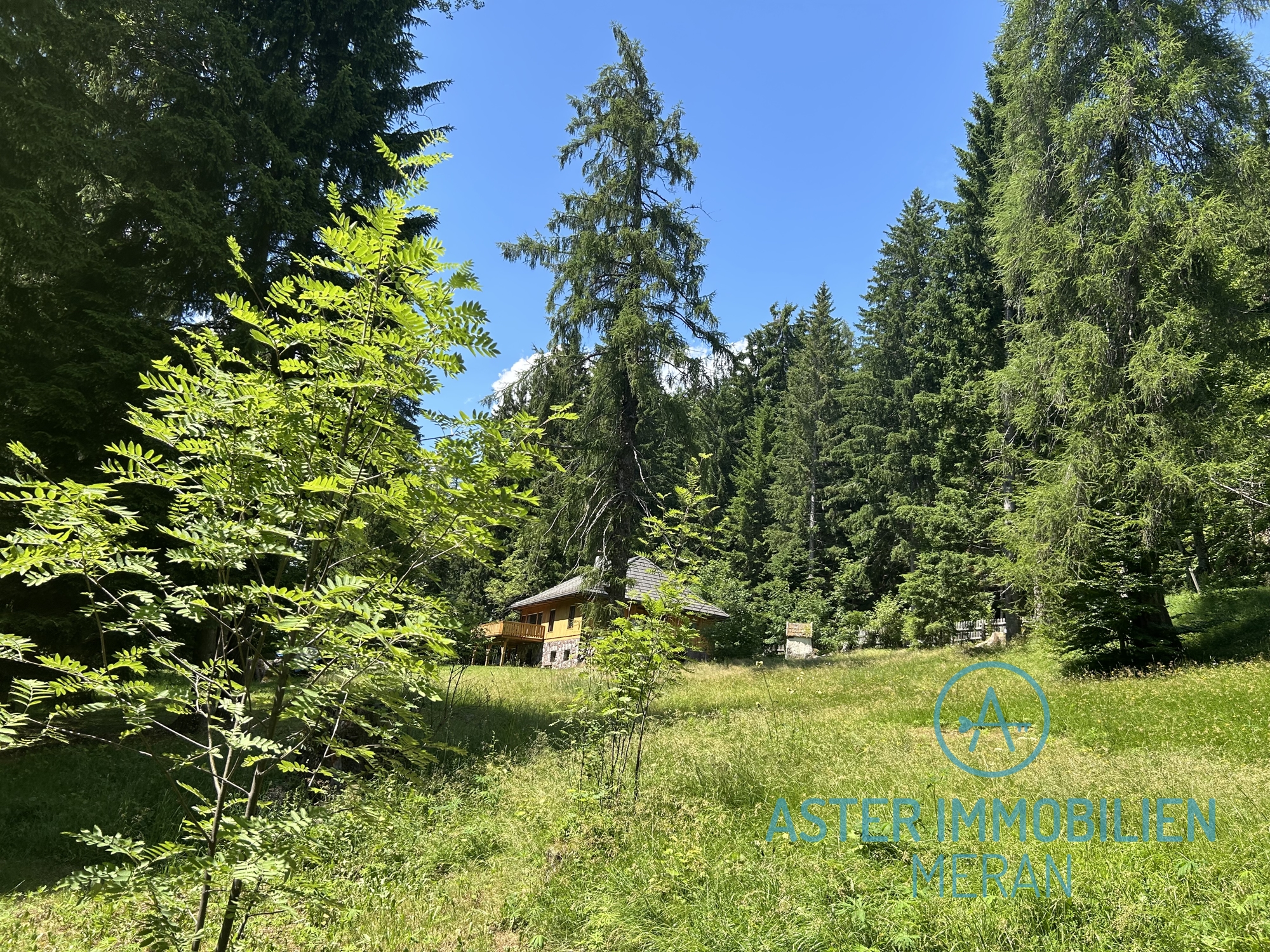
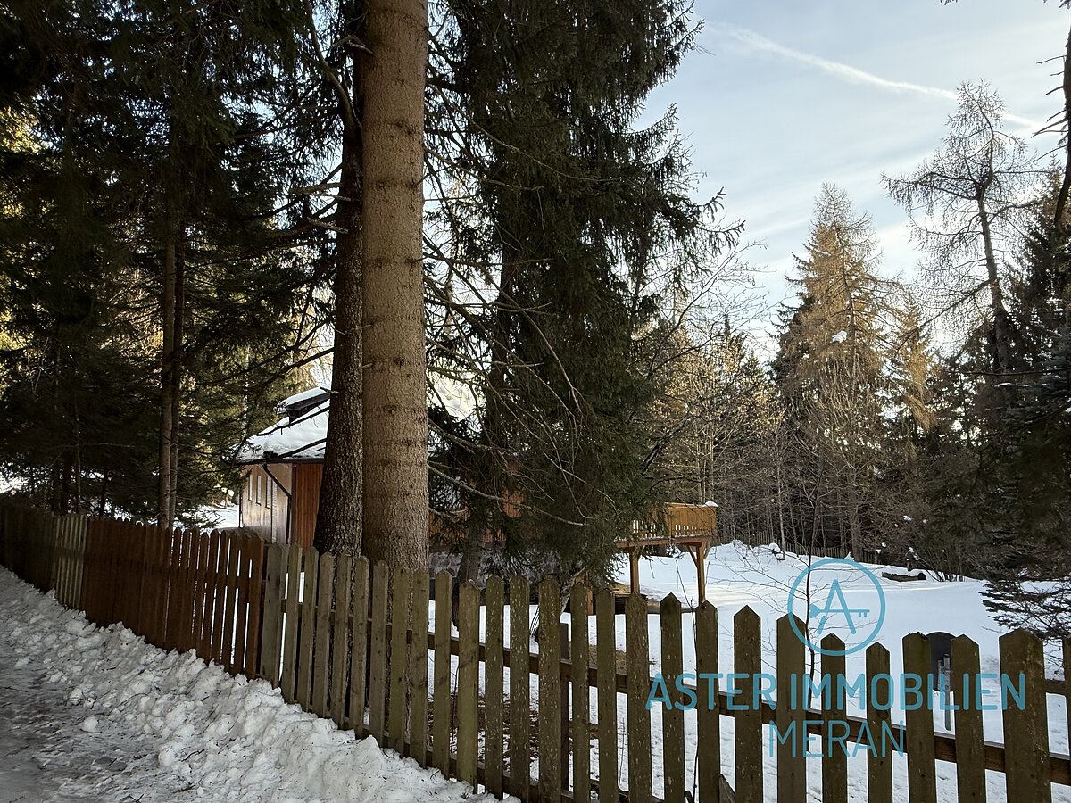
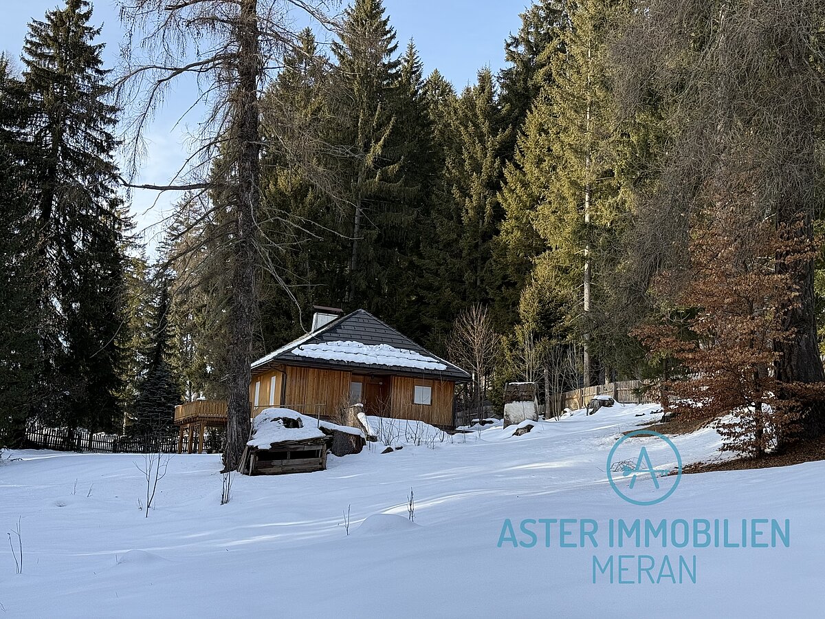
Charming historic vacation home in Hafling - pure peace and nature
AvelengoAvelengo
on request


general
- object number external:
- AI1199
- marketing method:
- purchase
- property:
- House
- elevator:
- no
- reserved for residents:
- no
Areas and amenities
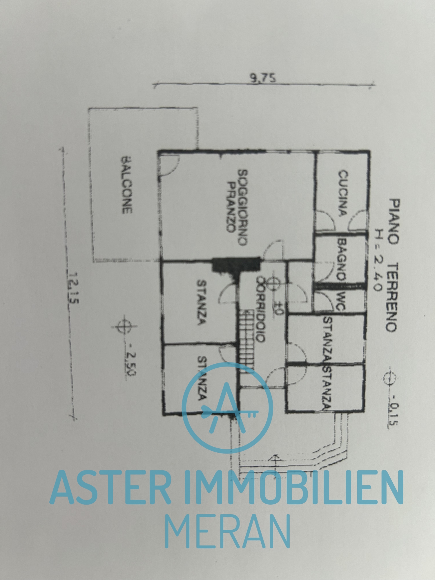
- living space:
- 120,00 m²
- balconies/terrace space:
- 20,00 m²
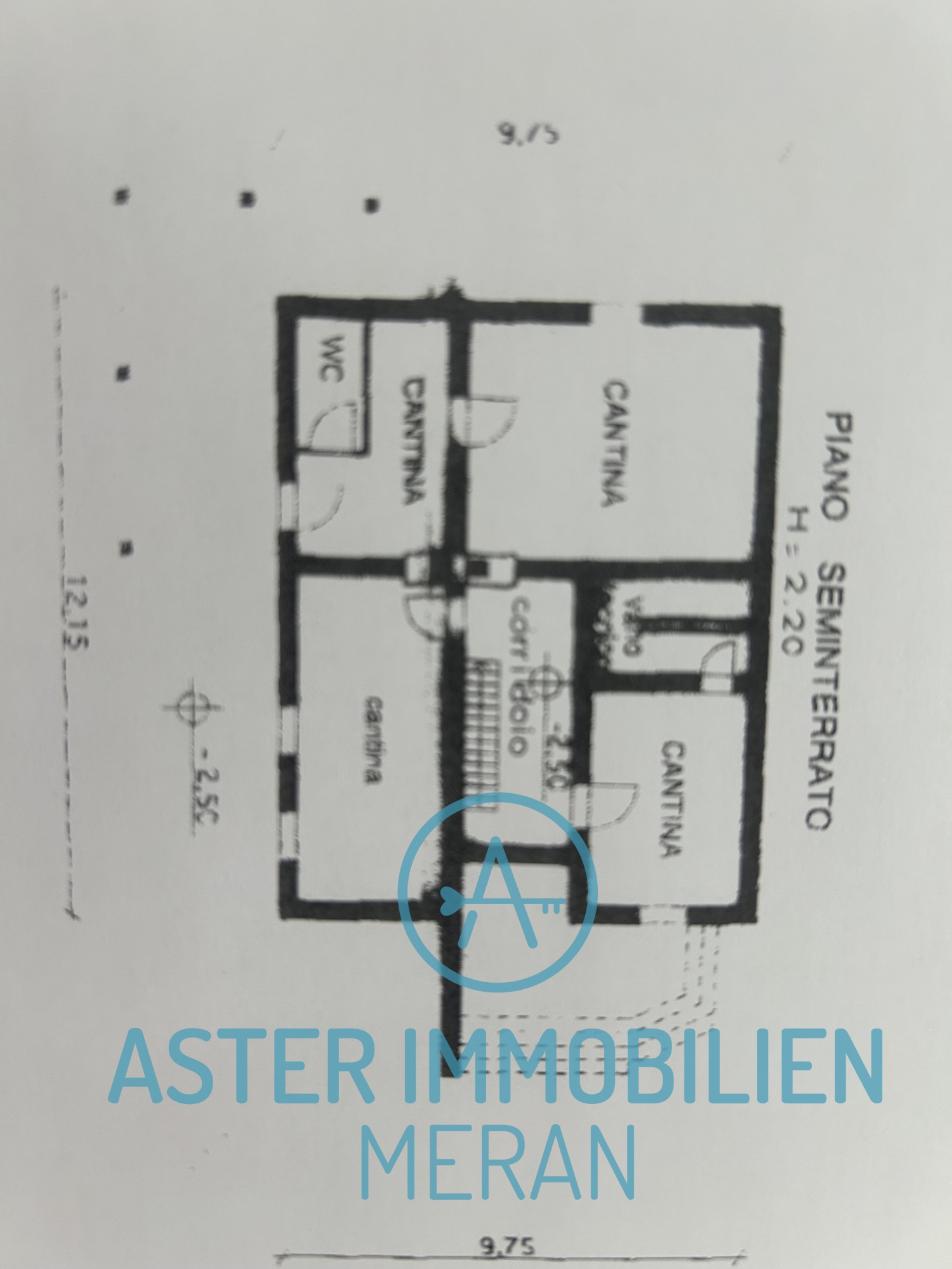
- cellar space:
- 100,00 m²
- Sales space:
- 850,00 m²
- Total size of site:
- 4.000,00 m²
- Number of Rooms:
- 6
- Number of bedrooms:
- 3
- Number of bathrooms:
- 2
- number of balconies:
- 2
- number of terraces:
- 1
- number of parking spaces:
- 4
Energetic efficiency
- construction year:
- 1965
- energy class:
- G
- Location:
- Hafling, also known as the "sun terrace of Merano", extends at 1,250 to 1,600 meters above sea level and is known as the namesake of the famous Haflinger horses. The area is popular as a hiking and leisure park. The area can be reached directly from Merano via a cable car from Falzeben. The skiing and hiking area is mainly located in the municipality of Hafling, 10 minutes away by car.
The municipality of Hafling lies in the north-west of the Tschögglberg, a mountain range that accompanies the Adige Valley between Merano and Bolzano on the east side. The two largest settlements, Hafling Dorf (1290 m) and Oberdorf (1400 m), are located in lower, mid-mountain locations in the area characterized by forests and meadows in the west of the municipality. In the north-east, the municipality reaches the peaks of the Sarntal Alps: the Verdinser Plattenspitze (2680 m), the Hochplattspitze (2615 m) and the Kleiner Ifinger (2552 m).
Contact person
- Company:
- Aster Immobilien Meran
- Name:
- Irene Aster
- Place:
- 39012 Meran / Merano
- Phone:
- 00393471758896
- Email:
- office@aster-immobilienmeran.it
